Order Total (1 Item Items):
Shipping Destination:

Abyssinia by Johnston (123 results)
Feedback
Skip to main search results
Search filters
Product Type
- All Product Types
- Books (111)
- Magazines & Periodicals (No further results match this refinement)
- Comics (No further results match this refinement)
- Sheet Music (No further results match this refinement)
- Art, Prints & Posters (No further results match this refinement)
- Photographs (No further results match this refinement)
- Maps (12)
- Manuscripts & Paper Collectibles (No further results match this refinement)
Condition
Binding
Collectible Attributes
- First Edition (7)
- Signed (No further results match this refinement)
- Dust Jacket (No further results match this refinement)
- Seller-Supplied Images (56)
- Not Print on Demand (72)
Language (3)
Free Shipping
Seller Location
Seller Rating
-

Condition: New.
More buying choices from other sellers on AbeBooks
New offers from US$ 24.00
Used offers from US$ 65.71
Also find Softcover
-

PAP. Condition: New. New Book. Shipped from UK. Established seller since 2000.
-

PAP. Condition: New. New Book. Shipped from UK. Established seller since 2000.
-

Travels in Southern Abyssinia, Through the Country of Adal to the Kingdom of Shoa Volume 2
Published by Hardpress Publishing, 2013
ISBN 10: 1314485873 ISBN 13: 9781314485875
Language: English
PAP. Condition: New. New Book. Shipped from UK. Established seller since 2000.
-

-

-

-

Travels in Southern Abyssinia Through the Country of Adal to the Kingdom of Shoa 1
Published by Hardpress Publishing, 2019
ISBN 10: 0371096766 ISBN 13: 9780371096765
Language: English
PAP. Condition: New. New Book. Shipped from UK. Established seller since 2000.
-

Travels in Southern Abyssinia, Through the Country of Adal to the Kingdom of Shoa Volume 1
Published by Hardpress Publishing, 2013
ISBN 10: 1314485865 ISBN 13: 9781314485868
Language: English
PAP. Condition: New. New Book. Shipped from UK. Established seller since 2000.
-

Travels in Southern Abyssinia, Through the Country of Adal to the Kingdom of Shoa
Published by HardPress Publishing, 2020
ISBN 10: 0461605627 ISBN 13: 9780461605624
Language: English
Seller: PBShop.store UK, Fairford, GLOS, United Kingdom
Seller rating 5 out of 5 stars

PAP. Condition: New. New Book. Shipped from UK. Established seller since 2000.
-

HRD. Condition: New. New Book. Shipped from UK. Established seller since 2000.
-

HRD. Condition: New. New Book. Shipped from UK. Established seller since 2000.
-

-

-

Travels In Southern Abyssinia V2: Through The Country Of Adal To The Kingdom Of Shoa (1844)
Published by Kessinger Publishing, 2009
ISBN 10: 1104513188 ISBN 13: 9781104513184
Language: English
Condition: New.
More buying choices from other sellers on AbeBooks
New offers from US$ 45.00
Used offers from US$ 46.13
Also find Softcover
-
Suez Canal. Verso: Abyssinia.
Publication Date: 1896
Seller: theoldmapman, Weston super Mare, United Kingdom
Seller rating 2 out of 5 stars

Map
Single sheet. Insets Suez and Port Said. Neat outline colouring. Verso: Abyssinia. Two images available. 20 x 26 cm.
-

Travels in Southern Abyssinia, Through the Country of Adal to the Kingdom of Shoa
Seller: Ria Christie Collections, Uxbridge, United Kingdom
Seller rating 5 out of 5 stars
Condition: New. In.
-

Travels in Southern Abyssinia, through the country of Adal to the kingdom of Shoa. (French Edition)
Published by British Library, Historical Print Editions, 2011
ISBN 10: 1240909926 ISBN 13: 9781240909926
Language: French
Condition: New.
-

Softcover. Condition: Very Good. 1904. A very presentable original engraving published in 'The Handy Royal Atlas of Modern Geography', 1904. Margins have some mild browning and thumb marks, but the image itself is clean and unmarked, with a vertical fold line as originally published, but no significant creases or wear. Why do most sellers not describe their actual item? Buy with confidence, support a genuine Independent Bricks & Mortar Real Bookshop and help to preserve our High Streets as interesting places to shop. We are Maynard & Bradley CAMBO & PBFA (now lapsed) members here in Leicester City Centr Size: 480 x 370 mm. 1 pages. Item Type: Book. Quantity Available: 1. Shipped Weight: Under 1 kilogram. Category: Geography & Maps; Britain/UK; 1900-1920; Pictures of this item not already displayed here available upon request. Inventory No: 27904.
-
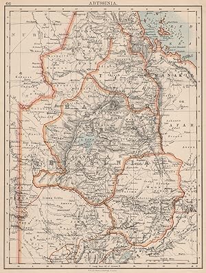
Condition: Good. HABESH or ABYSSINIA. Tigre Amhara Shoa Godjam. Ethiopia. JOHNSTON 1900 old map. Antique colour map; W. & A.K. Johnston, Limited, Edinburgh & London (1900). 28.0 x 21.5cm, 11 x 8.25 inches. Condition: Good. The image shown may have been taken from a different example of this map than that which is offered for sale. The map you will receive is in good condition but there may be minor variations in the condition from that shown in the image. There are images and/or text printed on the reverse side of the picture. In some cases this may be visible on the picture itself or around the margin of the picture.
-
Condition: Good. HABESH or ABYSSINIA. Tigre Amhara Shoa Godjam. Ethiopia. JOHNSTON 1899 old map. Colour antique map; W. & A.K. Johnston (1899). 27.0 x 21.0cm, 10.5 x 8.25 inches. Condition: Good. The image shown may have been taken from a different example of this map than that which is offered for sale. The map you will receive is in good condition but there may be minor variations in the condition from that shown in the image which may include some light spotting. There are images and/or text printed on the reverse side of the picture. In some cases this may be visible on the picture itself or around the margin of the picture.
-
Condition: Good. HABESH or ABYSSINIA. Tigre Amhara Shoa Godjam. Ethiopia. JOHNSTON 1906 map. Colour antique map; W & AK Johnston (1906). 20.5 x 26.5cm, 8 x 10.5 inches. Condition: Good. The image shown may have been taken from a different example of this map than that which is offered for sale. The map you will receive is in good condition but there may be minor variations in the condition from that shown in the image. There are images and/or text printed on the reverse side of the picture. In some cases this may be visible on the picture itself or around the margin of the picture.
-

Travels in Southern Abyssinia (Volume 1)
Seller: Phatpocket Limited, Waltham Abbey, HERTS, United Kingdom
Seller rating 5 out of 5 stars
Condition: Like New. Used - Like New. This is a reproduction of an out of print title. This book may have occasional imperfections such as missing or blurred pages, poor pictures, errant marks, etc. that were either part of the original artifact, or were introduced by the scanning process. Your purchase helps support Sri Lankan Children's Charity 'The Rainbow Centre'. Our donations to The Rainbow Centre have helped provide an education and a safe haven to hundreds of children who live in appalling conditions.
-
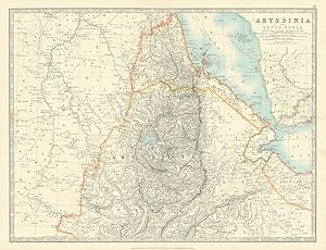
![Seller image for Map of Upper Nubia and Abyssinia [ taken from Johnston's Handy Royal Atlas ] for sale by Keoghs Books](https://pictures.abebooks.com/inventory/md/md510759876.jpg)
Map of Upper Nubia and Abyssinia [ taken from Johnston's Handy Royal Atlas ]
Published by Published by W. & A.K. Johnston, Edinburgh, 1878
Seller: Keoghs Books, Skipton, United Kingdom
Association Member: PBFA
Seller rating 5 out of 5 stars
Map First Edition
, 36.5 x 47.5 cm engraved map with colour, 2 cm margins, a double page plate with guard mount, heavy paper with gilt edge, numbered 39 First Edition thus , central fold with slight tear, paper toned, good condition 47.5 x 36.5 cm Map ISBN:
-
Travels In Southern Abyssinia Through The Country Of Adal To The Kingdom Of Shoa In Two Volumes
Published by J. Madden And Co., London, 1844
Language: English
First Edition
Cloth. Condition: Very Good. No Jacket. 1st Edition. Both Volumes Are Very Good For Their Age. Vol 1 Has Front And Rear Gutters Cracked And A Small 3Mm Hole On The Top Of The Spine, Foredge Uncut. Pp 492 , Tissue Protected Frontis Vol 2 Light Handling Wear,Uncut Foredge Pp 447 Tissue Protected Frontis . Folding Map 8 Page Publishers Catalog At The Rear.
-
Condition: Good. HABESH or ABYSSINIA. Tigre Amhara Shoa Godjam. Ethiopia. JOHNSTON 1895 old map. Antique colour map; W. & A.K. Johnston, Limited, Edinburgh & London (1895). 27.5 x 21.0cm, 11 x 8.25 inches. Condition: Good. The image shown may have been taken from a different example of this map than that which is offered for sale. The map you will receive is in good condition but there may be minor variations in the condition from that shown in the image. There are images and/or text printed on the reverse side of the picture. In some cases this may be visible on the picture itself or around the margin of the picture.
-
Condition: Good. ABYSSINIA & UPPER NUBIA. Ethiopia Erirtrea French Somaliland. JOHNSTON 1912 map. Antique colour atlas map; Scale 1: 3,700,000; W. & A.K. Johnston, Limited, Edinburgh & London (1912). 34.5 x 44.0cm, 13.5 x 17.25 inches; this is a folding map. Condition: Good. There is nothing printed on the reverse side, which is plain.
-

Upper Nubia and Abyssinia.
Published by Edimburgh & London, W. & A.K. Johnston, senza ma, 1879
Seller: S.B. Il Piacere e il Dovere, Vercelli, VC, Italy
Seller rating 5 out of 5 stars
Carta geografica in scala 1: 2.854.868 (45,075 miles to an inch) di cm. 49 x 58, con confini e coste delineati in colore e corsi d'acqua in azzurro, montata su tela a riquadri all'epoca e con copertine in cartoncino bordeaux e etichetta con titolo manoscritto; piccola erosione superficiale sulla indicazone della scala, ma molto buona e pulita. VG. ** Carta n. 42 del "The Royal Atlas Of Modern Geography". Al centro dell'area rappresentata si trova il Lago Tana.
-

Condition: Good. Upper Nubia and Abyssinia. Ethiopia Sudan Eritrea. 50x60cm. JOHNSTON 1876 map. Large, folio antique nineteenth century atlas map; Alexander Keith Johnston (1876). 47.0 x 60.0cm, 18.5 x 23.75 inches; this is a folding map. Condition: Good. There is nothing printed on the reverse side, which is plain.
-
Condition: Good. ABYSSINIA & UPPER NUBIA. Ethiopia Erirtrea French Somaliland. JOHNSTON 1913 map. Antique colour atlas map; Scale 1: 3,700,000; W. & A.K. Johnston, Limited, Edinburgh & London (1913). 34.5 x 44.0cm, 13.5 x 17.25 inches; this is a folding map. Condition: Good. There is nothing printed on the reverse side, which is plain.