
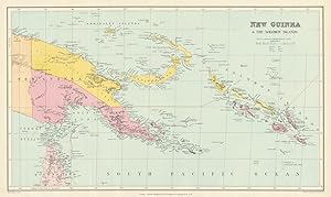
New Guinea & the Solomon Islands
Stanford, Edward
Publication Date: 1894
Map
Condition: Good
From Antiqua Print Gallery, London, United Kingdom
Seller rating 4 out of 5 stars
![]()
AbeBooks Seller since January 14, 2022
Used -
Price:
US$ 204.94
Convert Currency
US$ 9.95
shipping from United Kingdom to U.S.A.
Destination, rates & speeds
Quantity: 1 available
Add to basket